

High Precision Drone Surveying and Mapping
Professional Drone Surveying for All Applications
-
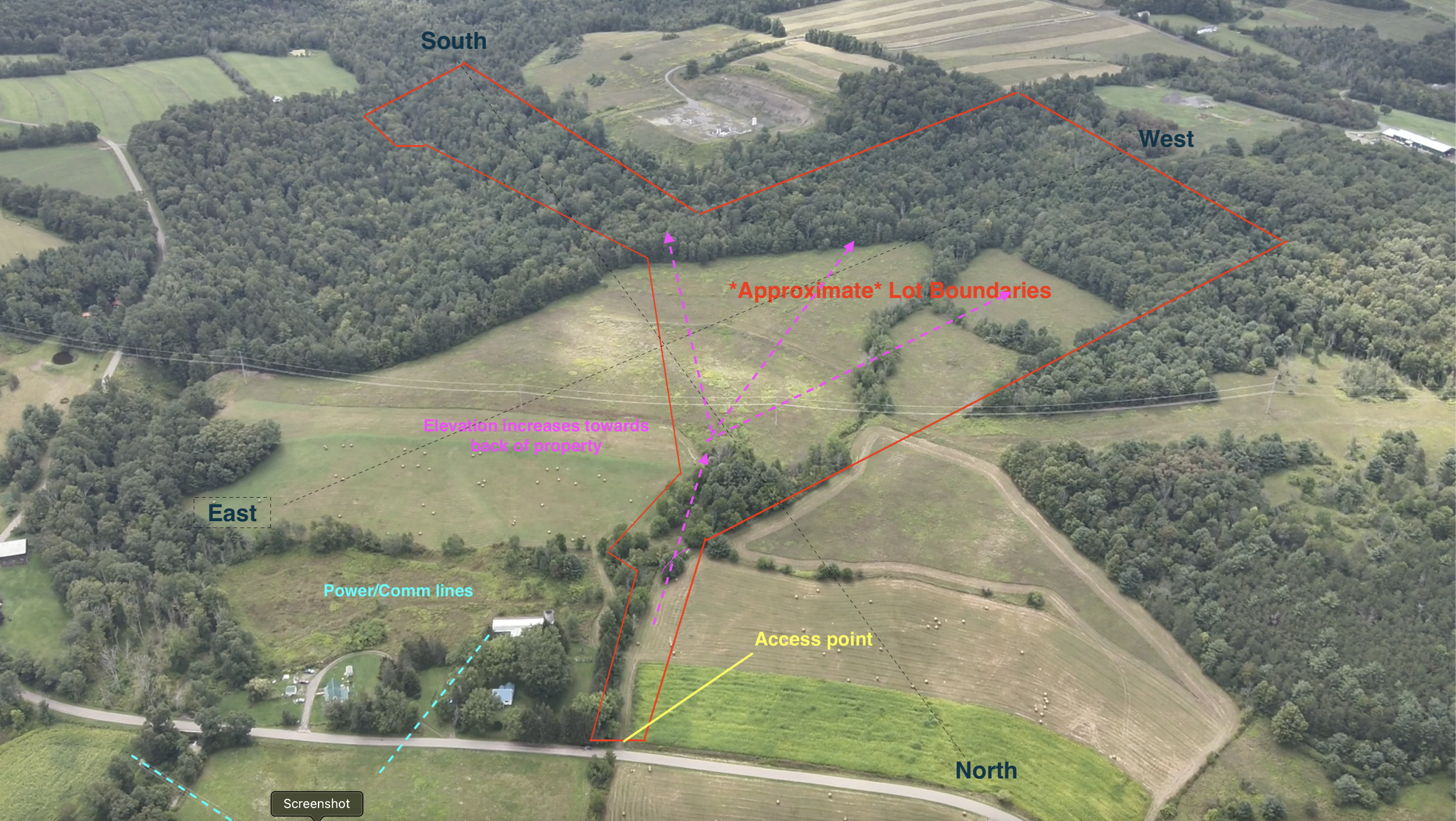
Complete Drone Land Survey
We offer in-depth aerial surveys for your property. In addition to beautiful media for your use in marketing, we offer a detailed property report that includes our analysis of suitable building locations, hazards, utilities, etc. Download our free sample report and contact us for a quote!
-

Parking and Traffic Patterns
We are the region's experienced pros when it comes to aerial data capture. This includes parking and traffic surveys, including time-stamped/gapless footage when requested. Whether it's a franchise location, a parking lot or an intersection, we can get you the data you need.
-
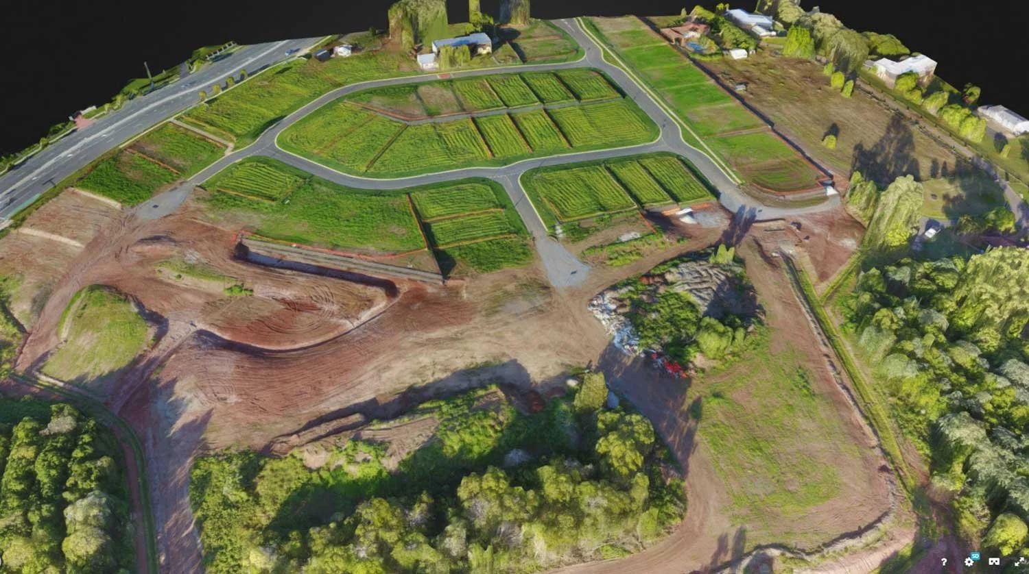
3D Modeling
We offer a number of 3D options to our clients, including both image and video-based data capture, point cloud data and more.
-
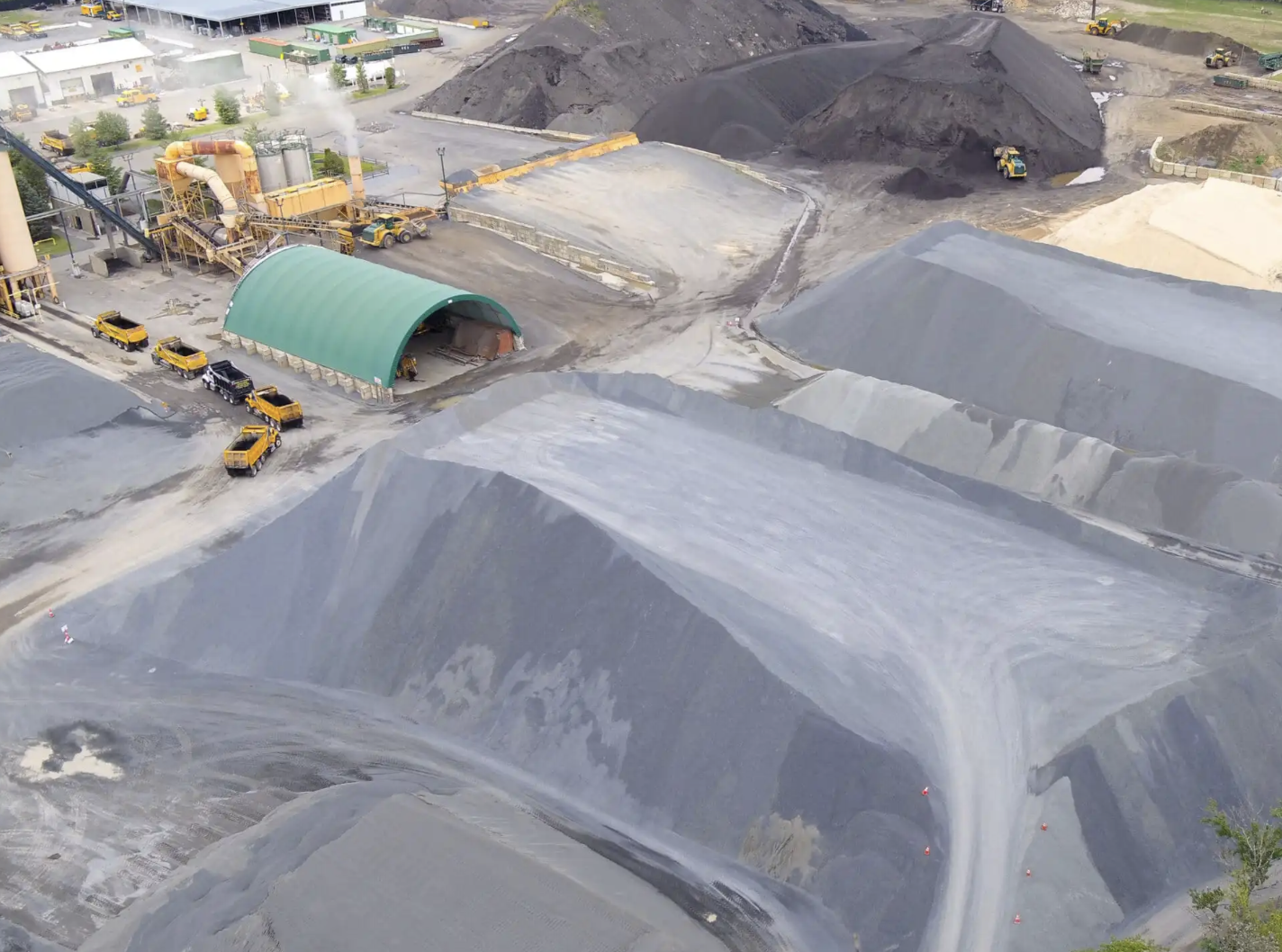
Volumetrics and Measurement
We offer aggregate volumetrics for excavation, landscaping, and all construction needs.
Learn More About What UAV Mapping Can Do for You

Mid-Atlantic Drone Services LLC is proud to service clients across Pennsylvania, New York, Delaware, New Jersey, Maryland, Virginia and more. We travel throughout the Mid-Atlantic and Northeast region frequently.
Out of the area? No problem. We have a nationwide network of FAA-certified drone pilots at our disposal. We offer pro drone services for roof and property inspection, volumetrics, search and rescue, commercial and residential real estate, security and surveillance, land survey, video production and marketing, thermal infrared, infrastructure and special events.
Contact us today for a quote!